1
The highest mountain of Sixt-Fer-à-Cheval isn't very easy to reach from this side. But the "Mont Blanc des Dames" is a "3000" that's accessible to any hiker capable of covering a high elevation gain in one day.
Comforts
Languages spoken
- French
Itinerary
- Duration: 9h00
- Maximum altitude: 3099 m
- Elevation: 1130 m
- Vertical drop: 1130 m
- Positive elevation: 1130 m
Prices
Free of charge.
This service provider also proposes
Complementary services
Guidebook with maps/step-by-step
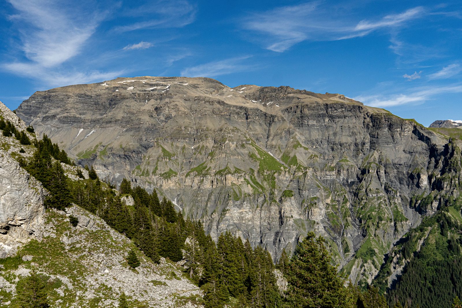
From Grenairon Refuge, follow the path towards the Buet, heading up the grassy slopes among the boulders. You'll then reach the Frêtes du Grenier, which you'll cross from one end to the other in a decor of rock (magnificent view of the Cirque des Fonts and the west face of the Buet). Afterwards, the path goes gently downhill to the small lake at the "Plan du Buet". At the intersection, just beyond the lake, ignore the path on the left leading up under the high-voltage power lines to the Buet valley, and take the right-hand path which zig-zags steeply up to the Buet ridge. Follow the ridge (aerial sections equipped with cables) to reach the Buet summit: you've made it to the top of Sixt!
The view of the Mont-Blanc massif is stunning. You can also see the Valais mountains on the Swiss side, some of them close, others in the distance, not to mention all the summits of Haute-Savoie: Aiguilles Rouges, Fiz, Aravis, Bargy, Chablais, etc.
Return to Grenairon Refuge by the same route, then descend to La Feulatière car park (2 possible routes, the narrow path, or the vehicle track).