1
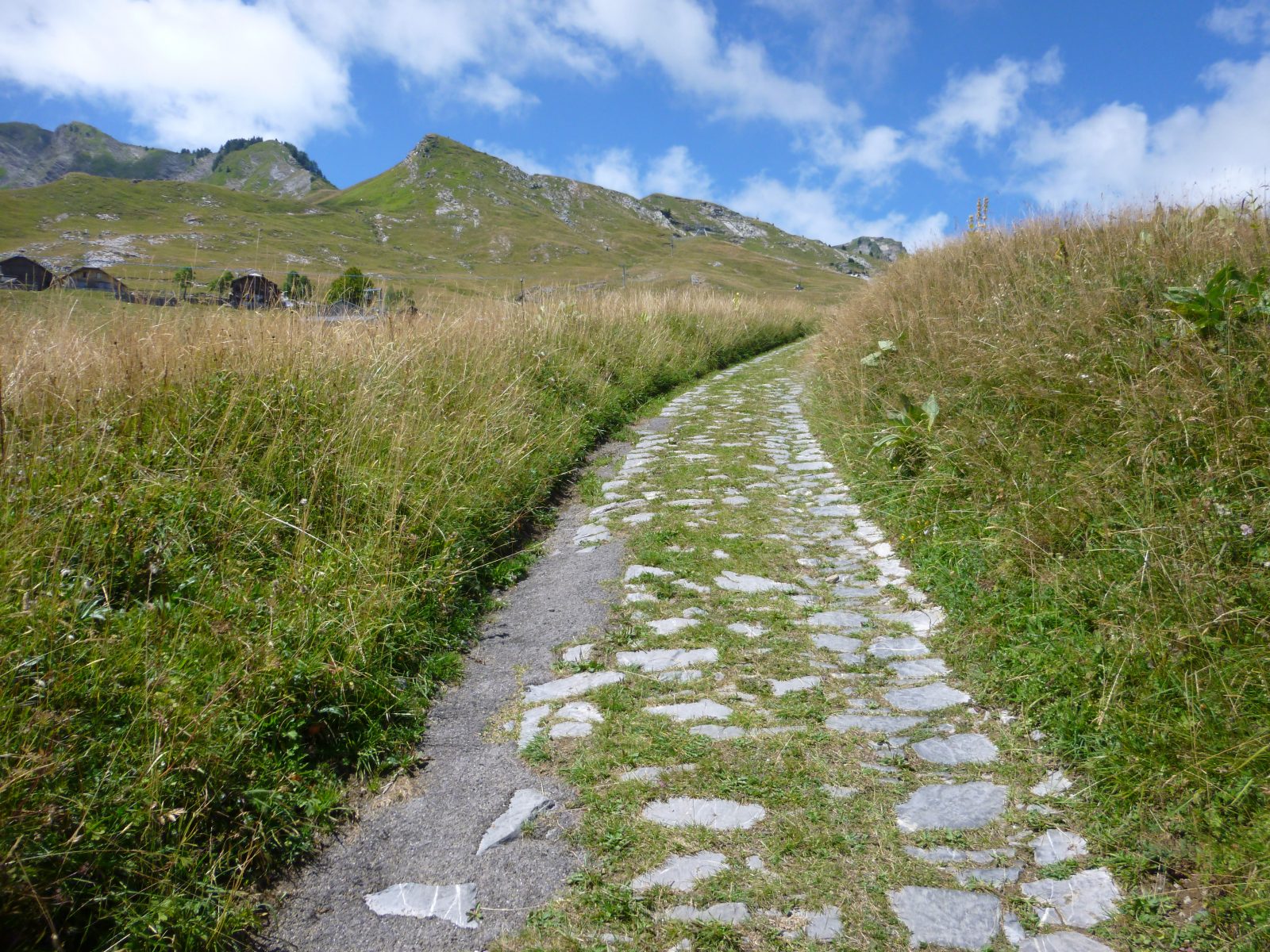
These stones were laid according to Roman techniques and the path was first used in the Middle Ages by the monks from the Chartreuse de Mélan to access Praz de Lys pastures 1,000m further up. For a long time, this was the only access to Praz de Lys.
Comforts
Services
- Pets welcome
Furniture
- Car park
- Public WC
Itinerary
- Distance: 11 km
- Duration: 4h50
- Type of land: Stone, Ground, Hard coating (tar, cement, flooring)
- Maximum altitude: 1527 m
- Elevation: 900 m
- Vertical drop: 900 m
- Positive elevation: 900 m
Prices
Free access.
This service provider also proposes

Complementary services
Guidebook with maps/step-by-step
From the Place du Château, follow the Montée du Sapeur (“Praz de Lys up the stone path”) on a small tarmac road and then carry on up a footpath. The stone path leads through the forest before reaching Pontet, at an altitude of 1,300m.
1/ The path then continues across the Praz de Lys pastures and you have the choice between heading towards Grand Planey and the Pic de Marcelly, or the centre of the resort.
2/ It is possible to walk up to Praz de Lys and come back down the same way.